Jul 23 2019
A new laser-based system, recently developed by researchers, can be used for airborne measurement of significant atmospheric gases with unparalleled resolution and accuracy.
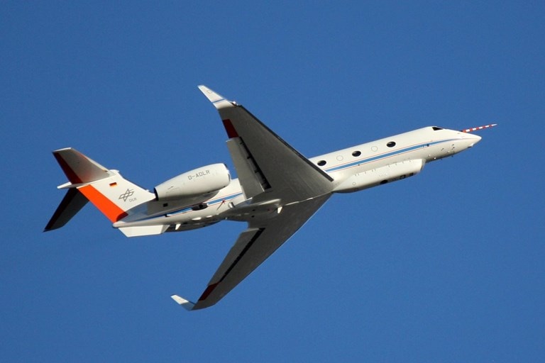
 Researchers developed a new LIDAR system that was used aboard the German research aircraft HALO (High Altitude and Long-Range Research Aircraft) to acquire the first simultaneous measurements of the vertical structure of water vapor and ozone in the tropopause region of the atmosphere. (Image credit: DLR)
The potential to obtain this information will help researchers to gain a better insight into how these atmospheric gases have an impact on the climate and can possibly help enhance predictions on climate change.
In the Optical Society journal Applied Optics, scientists from Deutsches Zentrum für Luft- und Raumfahrt e.V. (DLR)—the national center for aerospace, energy and transportation research in Germany—demonstrated how their LIDAR instrument was utilized onboard an aircraft to obtain the first concurrent measurements of the vertical structure of ozone and water vapor in the atmosphere’s tropopause region.
According to the researchers, the latest system could also prove handy for tracking atmospheric gases from space.
The tropopause region isolates the surface-based troposphere layer where weather occurs from the overlying stratosphere containing the ozone layer that safeguards life on Earth from dangerous radiation.
Investigators are mining to explore water vapor and ozone in the tropopause region because within this layer, the distribution of these atmospheric gases has an important role to play in the Earth’s climate.
The ability to detect the vertical structure of water vapor and ozone is critical for understanding the exchange of these atmospheric gases between the troposphere and the stratosphere. These measurements could help us identify errors and uncertainties in climate models that would help improve predictions of the future climate, which is one of the central challenges for our society and economy.
Andreas Fix, Study Lead, DLR
Gaining a 3D Perspective
It is possible to assess atmospheric gases with the data obtained from satellites or using instruments flown into the atmosphere. Conversely, such methods failed to give a complete picture of the distribution of atmospheric gas. This is because either they do not offer a sufficiently high resolution or lack the vertical component.
While instruments carried with balloons, called balloon sondes, are capable of providing highly resolved vertical profiles, they do not provide comprehensive temporal resolution and can only be employed at specified locations.
In order to solve these issues, the scientists created a LIDAR device that utilizes laser light to determine both water vapor and ozone simultaneously. Their method, known as differential absorption LIDAR (DIAL), employs a pair of slightly varied UV wavelengths to determine each gas. While the gas molecules mostly absorbed the UV radiation at one wavelength, most of the other wavelength is reflected.
Thus, determining the ratio of the UV signals returning from the atmosphere makes it possible to calculate an in-depth gas profile.
The gas profiles produced with the latest LIDAR system show a horizontal resolution of around 10 km and a vertical resolution of about 250 m below the flight track of the aircraft.
This vertical capability is a significant advancement in studying exchange processes at the tropopause. It helps overcome significant shortcomings in resolving the fine-scale distribution that have made it difficult to understand processes responsible for exchange at the tropopause.
Andreas Fix, Study Lead, DLR
Achieving Energy Efficiency
In order to execute this technique aboard a plane, the investigators utilized a highly efficient optical parametric oscillator (OPO) that was earlier developed by them to change the laser output to the UV wavelengths required to determine ozone and water vapor.
“The conversion needs to be very energy efficient to generate UV radiation with adequate pulse energies and high average power from the limited energy available onboard an aircraft,” explained Fix.
Upon testing, the new LIDAR device exhibited that its precision matched perfectly with that of balloon sondes. In the year 2017, the scientists flew the novel system aboard the wave-driven isentropic exchange (WISE) mission, in which numerous long-range flights were used over the Northern Europe and North Atlantic.
The team eventually discovered that the instrument operated exceptionally well, continued to be stable during use, and can determine the characteristic distributions of water vapor and ozone at the tropopause region.
The scientists are planning to examine the novel vertical-component data obtained during WISE and combine it into climate models. They are expecting to utilize the instrument to obtain atmospheric gas data aboard upcoming flights.