Jul 26 2010
Leica Geosystems, developer of advanced laser scanners, announced the successful completion of Mt. Rushmore National Memorial’s 3D survey using its software and scanners. A non-profit organization, CyArk, conducted the project in collaboration with the Glasgow School of Art, Historic Scotland, and the National Park Service.
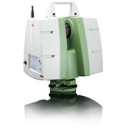
 Leica ScanStation C10
CyArk uses digital modeling, laser scanning and other advanced technologies to preserve the cultural heritage sites. The CyArk 500 initiative is a universal effort to preserve the top 500 heritage places digitally. The Rushmore project was one of the CyArk 500 initiatives.
Leica Geosystems supplied its laser scanners for the Rushmore project, where three different teams utilized five Leica laser scanners.
Justin Barton, Leica Geosystems’ Project Manager, stated that three different laser scanners, namely the ScanStation C10, the HDS6100, and the ScanStation 2, were used for the project.
The laser scanners captured billions of points and thousands of photographs. Leica’s Cyclone software was used to process the data from all the scanners from a command center. The data was collected and registered continuously to make certain that field teams had the latest data to work upon and that no important areas are left out. The Cyclone software was also utilized to show point cloud data to park officials and visitors during the project.