Researchers from the University of Science and Technology discovered a lightweight, compact, single-photon lidar system that uses a low-power laser to capture high-resolution 3D images. The research was published in Optica.
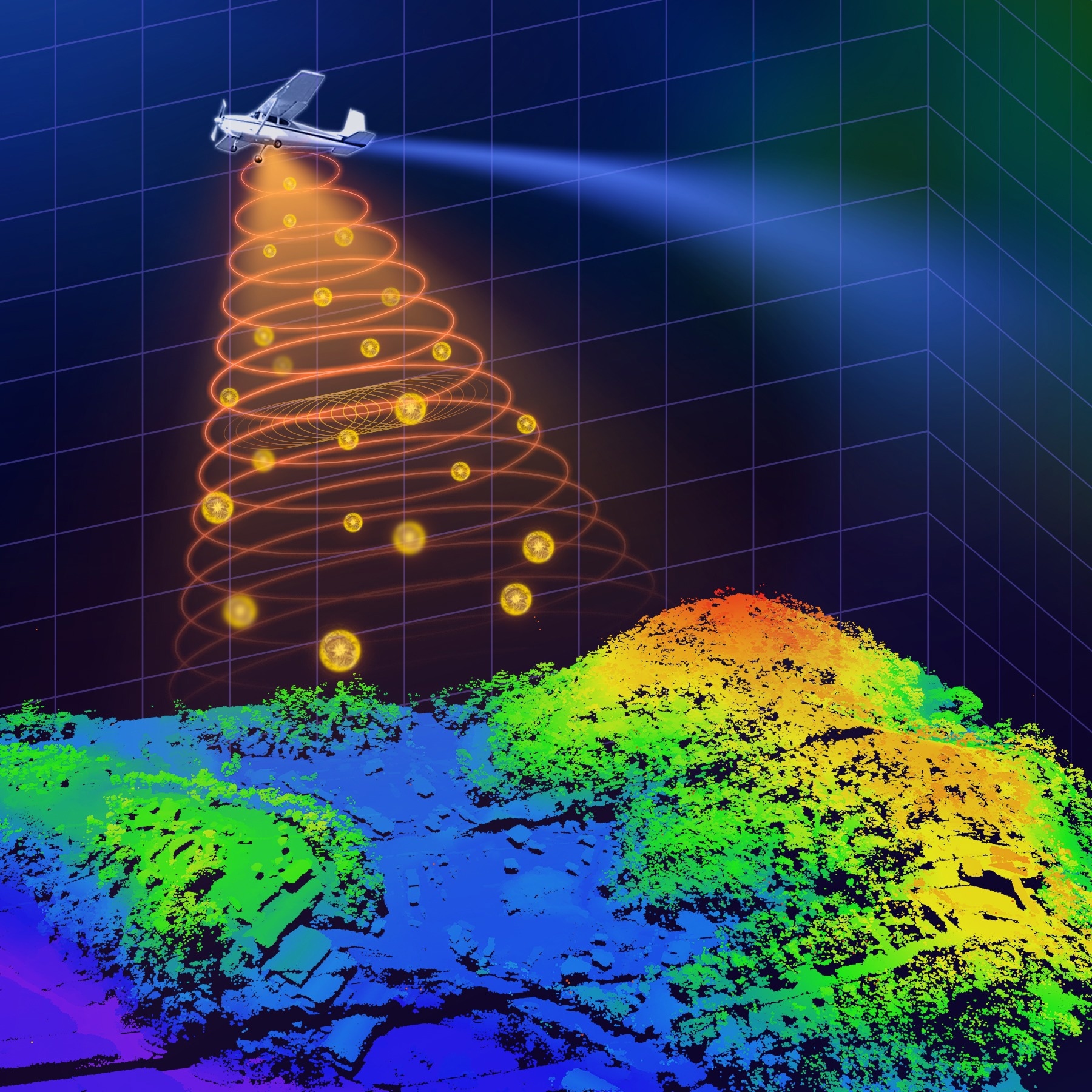 A new compact and lightweight single-photon airborne lidar system could make single-photon lidar practical for air and space applications such as 3D terrain mapping. Image Credit: Feihu Xu, University of Science and Technology of China
With this development, single-photon lidar may become feasible for use in space and aviation for tasks like object identification, 3D terrain mapping, and environmental monitoring.
Single-photon lidar measures the time it takes for laser pulses to reach an object and return using single-photon detection techniques. Because it allows for extremely accurate 3D mapping of terrain and objects, even in difficult environments like dense vegetation or urban areas, it is beneficial for applications that require aerial flight.
Using single-photon lidar technology on resource-limited drones or satellites requires shrinking the entire system and reducing its energy consumption, we were able to incorporate recent technology developments into a system that, in comparison to other state-of-the-art airborne lidar systems, employs the lowest laser power and the smallest optical aperture while still maintaining good performance in terms of detection range and imaging resolution.
Feihu Xu, University of Science and Technology of China
The researchers demonstrated that, when combined with sub-pixel scanning and a novel 3D deconvolution algorithm, the system can achieve an imaging resolution that exceeds the diffraction limit of light. They also showed how the system can be used to take daytime, high-resolution 3D images over wide areas on a small aircraft.
Ultimately, our work has the potential to enhance our understanding of the world around us and contribute to a more sustainable and informed future for all, for example, our system could be deployed on drones or small satellites to monitor changes in forest landscapes, such as deforestation or other impacts on forest health. It could also be used after earthquakes to generate 3D terrain maps that could help assess the extent of damage and guide rescue teams, potentially saving lives.
Feihu Xu, University of Science and Technology of China
Shrinking Single-Photon Lidar
The novel aerial single-photon lidar apparatus directs laser light pulses in the direction of the earth. Single-photon avalanche diode (SPAD) arrays are extremely sensitive detectors that pick up these pulses after they bounce off objects.
With these detectors' increased sensitivity to single photons, reflected laser pulses can be detected more effectively, allowing for the use of lower-power lasers. The researchers employed tiny telescopes with a 47 mm optical aperture as the receiving optics to minimize the size of the entire system.
The duration of light travel to and from the ground can be computed by measuring the time-of-flight of the returned single photons. From this data, the intricate 3D pictures of the terrain can subsequently be created using computational imaging algorithms.
A key part of the new system is the special scanning mirrors that perform continuous fine scanning, capturing sub-pixel information of the ground targets, also, a new photon-efficient computational algorithm extracts this sub-pixel information from a small number of raw photon detections, enabling the reconstruction of super-resolution 3D images despite the challenges posed by weak signals and strong solar noise.
Feihu Xu, University of Science and Technology of China
Ground and Air Testing
To confirm the new system's capabilities, the researchers ran several tests. A pre-flight ground test validated the technique's efficacy, which also demonstrated that the system's default settings allowed for 15 cm resolution lidar imaging at a distance of 1.5 km.
The researchers then used sub-pixel scanning and 3D deconvolution, which showed an effective resolution of 6 cm at the same distance.
Using a tiny aircraft, the researchers tested the system during the day for a few weeks in Yiwu City, Zhejiang Province, China. These tests successfully revealed specific characteristics of various objects and landforms, verifying the system's dependability and functionality in practical settings.
The team's long-term objective is to deploy the system on a spaceborne platform, such as a small satellite. To this end, the team is working to improve the system's performance and integration. Before the system is commercialized, it must also be improved in terms of stability, robustness, and affordability.
Journal Reference:
Hong, Y., et al. (2024) Airborne single-photon LiDAR towards small-size and low-power payload. Optica. doi.org/10.1364/optica.518999
Source: https://www.optica.org/